Thursday, 26 August 2021

BC's Agricultural Land Reserve

The ALR is a land term that has been around in BC for decades. Most people know it has something to do with farmland, but what is the ALR exactly? Can you build in the ALR zone? What does it mean to own land in the ALR?


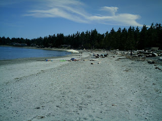
ALR land Haida Gwaii

According to the BC Government: The Agricultural Land Reserve (ALR) is a provincial land zone in which agriculture is recognized as the priority use. Farming is encouraged and non-agricultural uses are restricted. ALR land makes up 5% of BC's total land-base.

This does not mean you can't simply live on ALR property. There is no requirement to farm, however there are restrictions on what else you can do on the land. Keep in mind that most ALR land is in an agriculture-rich area, so even if you are not farming your land it is probable that properties around you are being used for agricultural purposes.

ALR land Quadra Island

Properties within the ALR should have it noted on their title, although the Agriculture Land Commission (who oversees the ALR) warns that this is not definitive. Mapping is a help in determining what land is within the ALR as well, and the ALC website hosts a number of mapping applications.

ALR mapping

The Vancouver Island region has ALR land in a number of areas, including in what might be thought of as rural residential areas close to urban centres, so it is good to do your homework when it comes to owning property in this distinct land class. This is something we research on our listings and provide mapping information for if a property does live

It's a Coastal Lifestyle ... Live It!

Thursday, 12 August 2021

Moorage in BC

 While some of our remote access listings can be reached by vehicle, the majority of them are water access. While the occasional buyer may have a float plane, for most people water access means arriving by boat.

So where does the boat park? Unlike a driveway which generally is on the owned property, docks and other moorage options are in the water, which is not owned privately. 

Docks must be granted permission by the government. In the past this meant a license of occupation, or a special permission document. Since 2017 many of the oceanfront properties in BC are covered under general permission, which does not require direct application to the government but does require adherence to certain rules.

Information on moorage in BC can be found here. This provides details on General Permission as well as when actual documentation and application is required (for instance if you do not own the upland directly in front of where you want to place the moorage).


Once the rules for moorage are understood, then begins the assessment for what type of moorage. Although most common, not all properties are candidates for docks due to location, weather conditions, extreme local tides, local boat traffic, etc. Mooring buoys, pulley/anchor systems and in some cases a local public dock are all options to be considered when a dock isn't the right solution.


It's a Coastal Lifestyle ... Live It!


Thursday, 22 July 2021

Vancouver Island Beaches Perfect for Summer

 Summer on Vancouver Island is generally warm, sunny and dry – perfect beach weather. This top 5 list is for beaches outside of Victoria that are perfect for summer relaxing.


·         Rathtrevor: This stretch of beach in Parksville is popular with tourists and locals alike, and big enough that there is room for everyone. At low tide the sandy beach stretches for miles. This is the site of one of the province’s most popular provincial parks, Rathtrevor Beach Provincial Park, as well as home to numerous resorts. No dogs are allowed on the beach in the summer months, so don’t bring Fido.


          Chesterman Beach: Tofino and Long Beach on the west coast of the island have many beaches to choose from, but Chesterman is a favourite with the locals and for good reason. With two beach fronts it is easy to be protected from any wind and to choose what wave action to play in. Both sides are nice and sandy, and the large space where the two beaches join gives lots of room for play.


      Saratoga:  Just north of popular Miracle Beach, Saratoga Beach is home to small resorts and RV campgrounds, as well as the popular Pacific Playgrounds Resort and Campground. Another sandy stretch, Saratoga has stunning views of the mainland coastal mountains and is great for a swim when the tide is coming in over the warm sand.

·         San Josef Bay: At the top of the island in the Cape Scott Provincial Park, San Josef is a walk-in beach well worth the easy 40 minute walk on good trails. With an interesting forest environment through the trails leading down to the marshy tidal area of the San Josef River, the beach itself is a shock with its stretches of sand broken only by amazing rock formations. This is a remote area, so the beach is never busy (although locals from Port Hardy do like to come there on sunny days).


·         China Beach: West of Sooke at the bottom of the island, China Beach is another one that requires a short hike to reach. It is well worth it though, with a long stretch of sandy beach, amazing views, and even a waterfall at one end of the beach close to the day use trail. This is also the head of the Juan de Fuca multi-day hiking trail. There is a small campground at China Beach, separate from the day use area.

These are all sandy beaches great for summer fun. Do you have a summer favourite?

It’s a Coastal Lifestyle ... Live It!

Thursday, 22 April 2021

Where Does the Waste Go?

On a remote or recreational property, figuring out the best way to dispose of waste water is important.

Indoor plumbing is generally an option, but it can be costly. All properties who choose to have indoor plumbing, and that are not on a municipal waste system, are supposed to have a permitted system, which means installation and inspection by a professional. In our region this is covered by the Island Health Authority. You can find more information about regulations for septic systems at the Island Health site here.

Many of the systems available still require pumping and disposal of the waste from a holding tank. These can be great options for those living on larger islands where pumping services are available (basically any of the islands serviced by ferries where the pump trucks can easily travel on and off island); however they are not such a great option for many recreational and more remote properties. There are also filtration systems and outflow systems, all of which direct the waste somewhere else (such as gravel fields or in some cases directly out to bodies of water). 


For most people when they think of cabins and remote properties, the traditional outhouse comes to mind. These are still very popular, and once established require little more than routine maintenance. Outhouses can be fun to decorate and they can range from incredibly rustic to quite fancy.


There are three waterless options for  toilets that property owners can consider. These can be inside a cabin or in an outhouse-style building.

*Composting Toilets. These are toilets that use aerobic processing through composting. This is a controlled composting system that protects the surrounding environment. These are popular systems and readily available in many countries. Here is some more explanation on how they work: http://www.letsgogreen.com/how-composting-toilets-work.html

a composting toilet, in an outhouse

*Incinerating Toilets. As the name implies these toilets burn the waste. This can be done in a few ways depending on the system's design but generally the waste is reduced to an ash in a holding tank and then can be safely disposed of. This is an information sheet from 1999 created by the EPA in the US, all about incinerating toilets: https://19january2017snapshot.epa.gov/www3/npdes/www3/pubs/incinera.pdf

*Evaporating Toilets. These systems actually dry-out the waste and create a sterile, compact waste that can be safely disposed of in the trash system. There are both passive systems that require no outside electricity and systems that do require some energy input. Evaporating toilets are very low maintenance. http://www.enviroalternatives.com/toiletcua.html

Dealing with waste is one of those less fun but practical things that is part and parcel of owning off-grid properties. The good thing is that there are solutions for every budget and every lifestyle!

It's a Coastal Lifestyle ... Live It!

Friday, 26 March 2021

Northern Vancouver Island Parks

Many people will continue to explore on Vancouver Island this summer as they stick within their region, and the northern end of the island has an abundance of space to investigate.

Provincial parks are plentiful on the northern end of Vancouver Island, and a travel itinerary could easily be compiled to do a road trip visiting a select number of them (or spend the whole time just visiting one of the bigger parks).

 1. At the top of the island is the famous Cape Scott. While people think of this as a serious hiker's park (for the well-known Cape Scott Trail) it has some easily accessible day-use areas, including the beautiful sandy San Josef Bay. Wilderness camping is allowed in this park, but there are no services. Just outside the San Josef entrance there is a private campground with cleared sites and picnic tables.

San Josef Trail

San Josef Bay, Cape Scott Park

2. Raft Cove is not far from Cape Scott, on the open west side of the top of the island. It is easier to access by boat however there is a short but sometimes challenging walking trail. Some people also choose to walk in from Cape Palmerston at low tide. The sweeping sand beach at Raft Cove is well worth the adventure to get there. This is a popular spot with intrepid surfers, who somehow manage to carry boards down the trail!

Raft Cove

3. There are a number of lake parks scattered around the north island - Woss LakeSchoen Lake and Nimpkish Lake are all provincial parks. Schoen Lake Park is the largest and actually comprises several lakes. At Schoen Lake there is a small campground accessible by forest service roads. Woss and Nimpkish Parks are mainly boat access and have no established amenities. Wilderness camping is permitted. All three parks offer visitors a glimpse into the rugged and remote beauty that makes up the interior of northern Vancouver Island.

4. Marble River, at the edge of Quatsino Sound, is an easy river park to access (via logging roads) and there is a forestry campsite just outside the park boundary. Marble River offers hiking and biking trails as well as good angling.

the Marble River Park surrounds most of Varney Bay 

A number of the parks on the north island are much more difficult to access and in fact some are almost inaccessible. Much of the access into the northern portion of the island is dependent on logging roads, and once a road is deactivated it is no longer serviced and can quickly become impassible. This has happened with the Artlish Caves Provincial Park, where there is now a hike in to the park as the logging road access was deactivated several years ago. These parks have been established to protect sensitive habitats and ecosystems, so creating access is not a priority for the parks program.

You can discover all the provincial parks (and ecological preserve areas) through the BC Parks website. A good place to start is the geographical locator page, which lets you zoom into the region you want to explore.

Vancouver Island north of Campbell River is a massive space that may seem empty as the communities are small and spread out, but for the intrepid explorer there are some beautiful areas to discover. Doing a circuit of Provincial Parks is just one way to get out there.

It's a Coastal Lifestyle ... Live It!

Thursday, 11 March 2021

East Side vs West Side Vancouver Island

 Most people don't think of islands as being very different from one side to the other. But Vancouver Island is a bigger island than many people realize and it differs greatly from one coast to the other.

Vancouver Island is approximately 460km long, 80km across at its widest, and has an area of just over 32,000km. It is the biggest island on the coast of North America. The defining feature of the island is the Vancouver Island Mountain Range which runs up the centre of the island. These mountains are home to Comox Glacier, Della Falls (Canada's largest waterfall) and the Golden Hinde, the highest peak on the island at 2,195 metres. These mountains effectively divide Vancouver Island into the east side and west side.

 Vancouver Island Mountains

The west coast of Vancouver Island is open to the Pacific Ocean. The constant wave action and storms of the open ocean have shaped this coast, which is famous for its deep bays with sandy beaches and windswept rocky coastline in between. There are fewer people living on the rugged west coast, and road access is limited to a few points of access from the east side of the island. The west coast constantly attracts outdoor enthusiasts for its rugged beauty, amazing open water fishing and stunning landscapes.

 
Rugged Point

Cox Bay

The east coast of the island, facing out to the Strait of Georgia (and the Salish Sea on the south end) is a much calmer coast by contrast. Typified by sandstone, cobblestone and smooth rock shorelines with pockets of sand beaches (notably in Parksville and between Courtenay and Campbell River) the east coast is more protected for the most part and less rugged. While winter storms still hit on the east coast, they are not as aggressive in wave action as on the west coast of the island.

Campbell River

Saanich

Saratoga Beach

The east coast also provides access to the mainland of BC through the ferry service from both Nanaimo and Victoria. The main highway system runs along the east side of the island, and most towns and cities have been built from the east coast inwards. While there are still more remote areas on the east coast of the island, most of them are north of Campbell River.

Discovery Passage, north of Campbell River

Thanks to its size and geography, Vancouver Island offers an array of outdoor experiences, from calm ocean kayaking among small islands in the Strait of Georgia to wild and wet storm watching on the west coast. Both sides of the island offer amazing beauty and incredible regions to explore, vacation in or call home.
West Coast Vancouver Island

It's a Coastal Lifestyle ... Live It!

Thursday, 18 February 2021

BCO Coastal Gems: Read Island

 Read Island sits in the heart of the Discovery Islands, with Maurelle Island to the North, Quadra Island to the west and Cortes Island to the Southeast. There is a large provincial park at the south end of the island and a government dock is located at Surge Narrows.


The census has approximately 80 people as full-time residents of the island, and there are many other part-time residents with summer cabins and residences.

school house

Read Island is home to Surge Narrows School, serving the outlying areas in the Discovery Islands for School District 72. Like most of the Discovery Islands, Read Island has a rich and varied history, having been home to loggers, farmers and homesteaders throughout the years.

Surge Narrows is at the junction where Read Island, Quadra Island and Maurelle Island meet and merges into White Rock Pass. This is a picturesque and protected location with quick, easy access to services and amenities located at Heriot Bay on Quadra Island or the larger centre of Campbell River on Vancouver Island. From here one is also minutes away from the BC mainland and majestic inlets such as Toba and Bute.

Read Island has a network of internal logging roads, which provide access throughout most of the island and to areas such as Surge Narrows, the Government Dock as well as the community hall and elementary school. Rosen Lake and 1550 acres of Provincial Park are both located on the south end of the island.
White Rock Pass

It’s a Coastal Lifestyle … Live It!