Thursday, 21 March 2019

BCO Coastal Gems: Port Alice

The west coast of Vancouver Island is marked by large inlets and remote villages and towns separated by wild coast and mountains. Only a few of the towns are accessible by paved road.


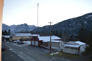
Port Alice is on the north-west of Vancouver Island, on the banks of Neroutsos Inlet. Often referred to as "The Gateway to the Wild West Coast", Port Alice draws fishermen looking to access the waters off Northern Vancouver Island as well as Neroutsos and Quatsino Inlets.

The town itself has approximately 660 residents. The main industry has historically been the local pulp mill. The town offers basic amenities and shopping as well as a marina and a golf course.

Beach in front of Port Alice

Port Alice is surrounded by amazing natural beauty, with great access to Alice and Victoria Lakes recreational areas. This is an area popular with outdoor enthusiasts. The climate is mild and wet, like most of the north island.

Alice Lake

To get to Port Alice is approximately a 3 - 3.5 hour drive from Campbell River, along highway that cuts through some very remote and beautiful coastal forest.

It's a Coastal Lifestyle ... Live It!

Thursday, 14 March 2019

Top 4 Northern Vancouver Island Provincial Parks

Provincial parks are plentiful on the northern end of Vancouver Island, and a travel itinerary could easily be compiled to do a road trip visiting a select number of them (or spend the whole time just visiting one of the bigger parks).

 1. At the top of the island is the famous Cape Scott. While people think of this as a serious hiker's park (for the well-known Cape Scott Trail) it has some easily accessible day-use areas, including the beautiful sandy San Josef Bay. Wilderness camping is allowed in this park, but there are no services. Just outside the San Josef entrance there is a private campground with cleared sites and picnic tables.

San Josef Trail

San Josef Bay, Cape Scott Park

2. Raft Cove is not far from Cape Scott, on the open west side of the top of the island. It is easier to access by boat however there is a short but sometimes challenging walking trail. Some people also choose to walk in from Cape Palmerston at low tide. The sweeping sand beach at Raft Cove is well worth the adventure to get there. This is a popular spot with intrepid surfers, who somehow manage to carry boards down the trail!

Raft Cove

3. There are a number of lake parks scattered around the north island - Woss LakeSchoen Lake and Nimpkish Lake are all provincial parks. Schoen Lake Park is the largest and actually comprises several lakes. At Schoen Lake there is a small campground accessible by forest service roads. Woss and Nimpkish Parks are mainly boat access and have no established amenities. Wilderness camping is permitted. All three parks offer visitors a glimpse into the rugged and remote beauty that makes up the interior of northern Vancouver Island.

4. Marble River, at the edge of Quatsino Sound, is an easy river park to access (via logging roads) and there is a forestry campsite just outside the park boundary. Marble River offers hiking and biking trails as well as good angling.

the Marble River Park surrounds most of Varney Bay 

A number of the parks on the north island are much more difficult to access and in fact some are almost inaccessible. Much of the access into the northern portion of the island is dependent on logging roads, and once a road is deactivated it is no longer serviced and can quickly become impassible. This has happened with the Artlish Caves Provincial Park, where there is now a hike in to the park as the logging road access was deactivated several years ago. These parks have been established to protect sensitive habitats and ecosystems, so access is not a priority.

You can discover all the provincial parks (and ecological preserve areas) through the BC Parks website. A good place to start is the geographical locator page, which lets you zoom into the region you want to explore.

Vancouver Island north of Campbell River is a massive space that may seem empty as the communities are small and spread out, but for the intrepid explorer there are some beautiful areas to discover. Doing a circuit of Provincial Parks is just one way to get out there.

It's a Coastal Lifestyle ... Live It!

Thursday, 7 March 2019

Where to Park the Boat... Moorage in BC

There are a lot of logistics involved in owning oceanfront (or lakefront) property. Many of the properties BC Oceanfront deals with are boat access properties, which means the main way to reach the property is by boat or float plane. So what are the rules for moorage at a property like this?


At one time to have a legally conforming dock required a foreshore lease or license of occupation. Then Specific Permission came into place, which allowed for an owner to register a dock once and not have to worry about renewing a lease or license. As of January 2017 the government has created what is known as General Permission, which would now apply to some property owners requiring docks. This authorization is handled by the Ministry of Forest, Lands and Natural Resource Operations. The BC Government information page on private moorage can be found here. All of these types of moorage authorization are still available, depending on the type of moorage required and other criteria (use of moorage, location, etc).


General Permission requires no application or fee to the government. There are certain requirements that are expected to be met when a dock is put in place, for example where the dock is placed and the size of the dock. Those are laid out clearly in the pdf document at this link: General Permission.


There are certain areas where General Permission cannot be used, including most of the south-eastern portion of Vancouver Island (and all the southern Gulf Islands). There are other criteria that would also make a location not qualify for General Permission, which can be found here.

There are occasions where a property owner may have moorage that is not connected to their property (for instance some inland property owners on small islands may have moorage at the end of a common access road or in front of another property) and in this case they would also need a different type of permission.

Sourcing out this type of information and knowing what is happening in the world of remote, recreational, waterfront properties is just part of what we do here at the BCO office.

It's a Coastal Lifestyle ... Live It!

Thursday, 28 February 2019

BCO Coastal Gems: Zeballos


Gold mining built the town of Zeballos in the 1930s, when gold was discovered in the hills surrounding the small port at the head of the Zeballos Inlet. The inlet was named after a Spanish lieutenant, Ciriaco Cevallos, in 1972.


At the height of the gold production, Zeballos was a thriving town of over 1500 people. However, the second world war and then a lower price of gold meant an end to the gold mines and the Village slowly reduced in size. Forestry is now the mainstay of the local economy, and approx. 100 people make Zeballos home year-round.


With its road access and the open waters of the Pacific Ocean and the waterways of Nootka Sound beckoning, Zeballos has become a choice destination for fishing and wilderness recreation. There is both fresh water and salt water fishing, as the Zeballos River runs through town.


Zeballos is on the west coast of Vancouver Island, accessed by road from Hwy 19 just north of Woss. This is a Forest Service gravel road and can be in varying condition throughout the year.


The small coastal hamlet is located approximately 14 nautical miles from the open west coast Pacific Ocean and is 17 nautical miles from Tahsis, a small coastal community in the neighbouring inlet to the south.


There are limited services, including a medical clinic, general store, marina and boat fuel sales. In the summer there are a number of accommodation options. Zeballos calls itself the Golden Gate to the West Coast. It offers access to Nootka Sound and the fishing on the west coast of the island, as well as the provincial parks of the northern Island (Woss, Brooks Peninsula, Cape Scott).

It's a Coastal Lifestyle ... Live It!


Thursday, 21 February 2019

The Two Coasts of Vancouver Island

Most people don't think of islands as being very different from one side to the other. But Vancouver Island is a bigger island than many people realize and it differs greatly from one coast to the other.

Vancouver Island is approximately 460km long, 80km across at its widest, and has an area of just over 32,000km. It is the biggest island on the coast of North America. The defining feature of the island is the Vancouver Island Mountain Range which runs up the centre of the island. These mountains are home to Comox Glacier, Della Falls (Canada's largest waterfall) and the Golden Hinde, the highest peak on the island at 2,195 metres. These mountains effectively divide Vancouver Island into the east side and west side.

 Vancouver Island Mountains

The west coast of Vancouver Island is open to the Pacific Ocean. The constant wave action and storms of the open ocean have shaped this coast, which is famous for its deep bays with sandy beaches and windswept rocky coastline in between. There are fewer people living on the rugged west coast, and road access is limited to a few points of access from the east side of the island. The west coast constantly attracts outdoor enthusiasts for its rugged beauty, amazing open water fishing and stunning landscapes.

 
Rugged Point

Cox Bay

The east coast of the island, facing out to the Strait of Georgia (and Strait of Juan de Fuca on the south end) is a much calmer coast. Typified by sandstone, cobblestone and smooth rock shorelines with pockets of sand beaches (notably in Parksville and between Courtenay and Campbell River) the east coast is more protected for the most part and less rugged. While winter storms still hit on the east coast, they are not as aggressive in wave action as on the west coast of the island.

Campbell River

Saanich

The east coast also provides access to the mainland of BC through the ferry service from both Nanaimo and Victoria. The main highway system runs along the east side of the island, and most towns and cities have been built from the east coast inwards. While there are still more remote areas on the east coast of the island, most of them are north of Campbell River.

Discovery Passage, north of Campbell River

Thanks to its size and geography, Vancouver Island offers an array of outdoor experiences, from calm ocean kayaking among small islands in the Strait of Georgia to wild and wet storm watching on the west coast. Both sides of the island offer amazing beauty and incredible regions to explore, vacation in or call home.
West Coast Vancouver Island

It's a Coastal Lifestyle ... Live It!

Thursday, 14 February 2019

Making an Eco Gift of Land

While most people know that you can donate property to a charitable organization to the government (for parkland, environmental area, etc), not everyone may know that if one chooses and the land qualifies, the gift can be classified as an "eco gift". This comes up in our area occasionally, as much of the land on the coast could be termed ecologically sensitive or near to ecologically sensitive land.

The federal government oversees the process of having a donation declared an ecological gift, and there are regulations and criteria regarding how a property qualifies.


Not only properties can be donated. One can also donate easements and covenanted areas. The donated parcel only needs to meet one of the criterion on the list, although most of them will meet more than one.

According to the federal government, an ecological gift can provide significant tax advantages to the donor and can ensure that a land's biodiversity and environmental value is protected into the future.


For more information, go to the Environment Canada Eco Gifts page.

You can also donate Land to non-profit organizations, such as Nature Trust. If this is something that interests you, be sure to talk to the organization and make sure your land meets their criteria.

It's a Coastal Lifestyle ... Live It!

Thursday, 7 February 2019

Where Does the Water Come From?


For those living in a city or other residential area, domestic water is generally taken for granted unless water restrictions are enacted. Water simply comes when you turn on the tap, and if it doesn’t you call your city or municipality and find out why.


For those who live outside the boundaries of cities and towns, domestic water can be one of the most important issues when establishing a home. Where will it come from? How will it be used? How much will be needed? All of these questions should be answered when considering a home on a remote or rural property. If the property already has a home in place, prospective buyers should be asking the same questions about any water system in place.

Domestic water outside of city water systems generally comes from three sources: groundwater through wells; surface water through springs, creeks or rivers; and rain water. (There are other options, such as desalination plants if one lives on the ocean or water delivery which many  road-access island communities use in the dry summers when wells and cisterns are empty.) Of these three, it is currently the use of surface water that requires a licence to access in BC.

The Water Act of BC defines what licencing is required and what that licence entitles one to. A licence will define where the water may be taken from, how much water will be taken and what the water will be used for. Information on domestic freshwater licences can be found here:  https://www2.gov.bc.ca/gov/content/environment/air-land-water/water/water-licensing-rights/water-licences-approvals

If the property has an existing well, it may be possible to look up information. The province does track wells installed by well drillers, however this database was voluntary before 2016. https://www2.gov.bc.ca/gov/content/environment/air-land-water/water/groundwater-wells-aquifers/groundwater-wells/information-for-property-owners/well-records-registration


Rain water collection is commonly done in a cistern, which can be either above or below ground. They are often hidden underneath a deck.

Many recreational and remote property owners use tanks to store additional water. This is especially useful on the west coast, where we tend to have plenty of water in the wet winter months and less in the summer months when the properties are seeing heavier use.


Knowing where the water is coming from, or what the options are to get water, makes for good peace of mind when considering an unconventional property.

It’s a Coastal Lifestyle … Live It!